NATIONAL MAPPING AND RESOURCE INFORMATION AUTHORITY
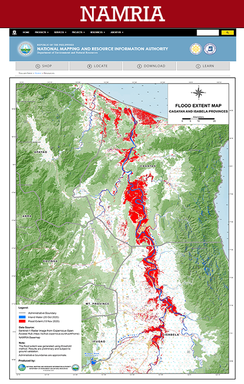
The University of the Philippines Cebu University Library is among the institutions nationwide identified by the central mapping agency of the government of the Philippines to be a repository of topographic maps that are used as base maps for other thematic maps like land cover, land condition, land classification, cadastral, etc.
NAMRIA is mandated to provide the public with mapmaking services and to act as the central mapping agency, depository, and distribution facility for natural resources data in the form of maps, charts, texts, and statistics.
NAMRIA. (2021). NAMRIA | The Central Mapping Agency of the Government of the Philippines. Retrieved from https://www.namria.gov.ph/
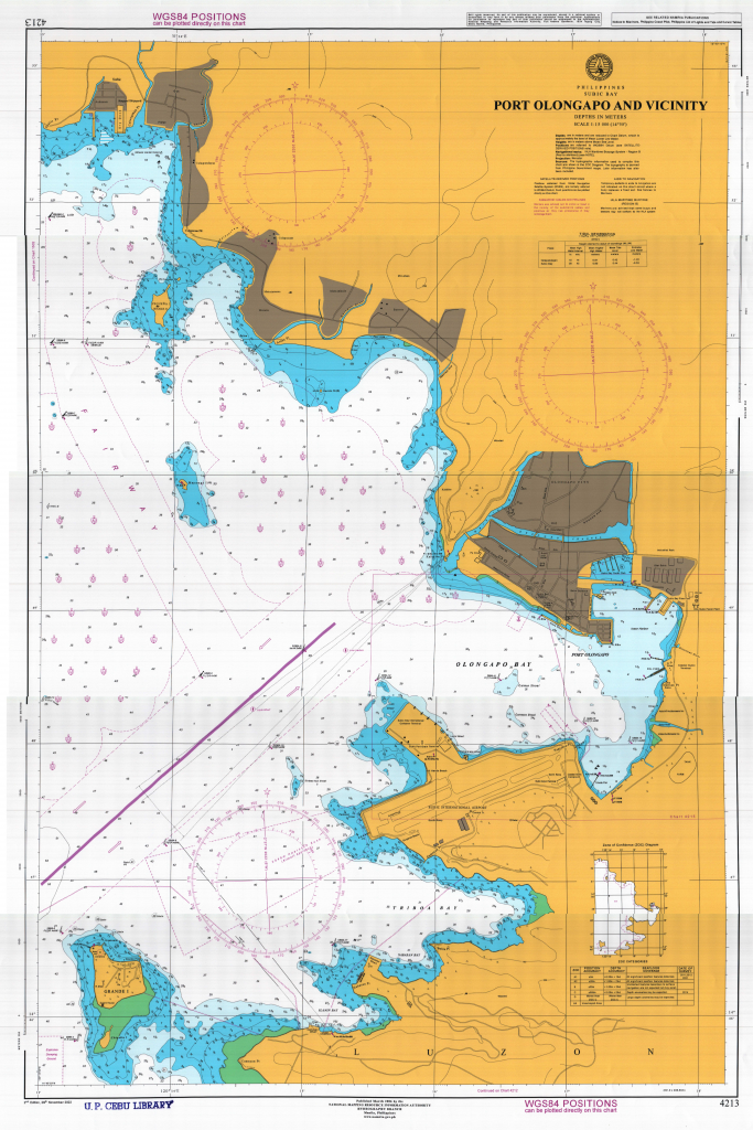
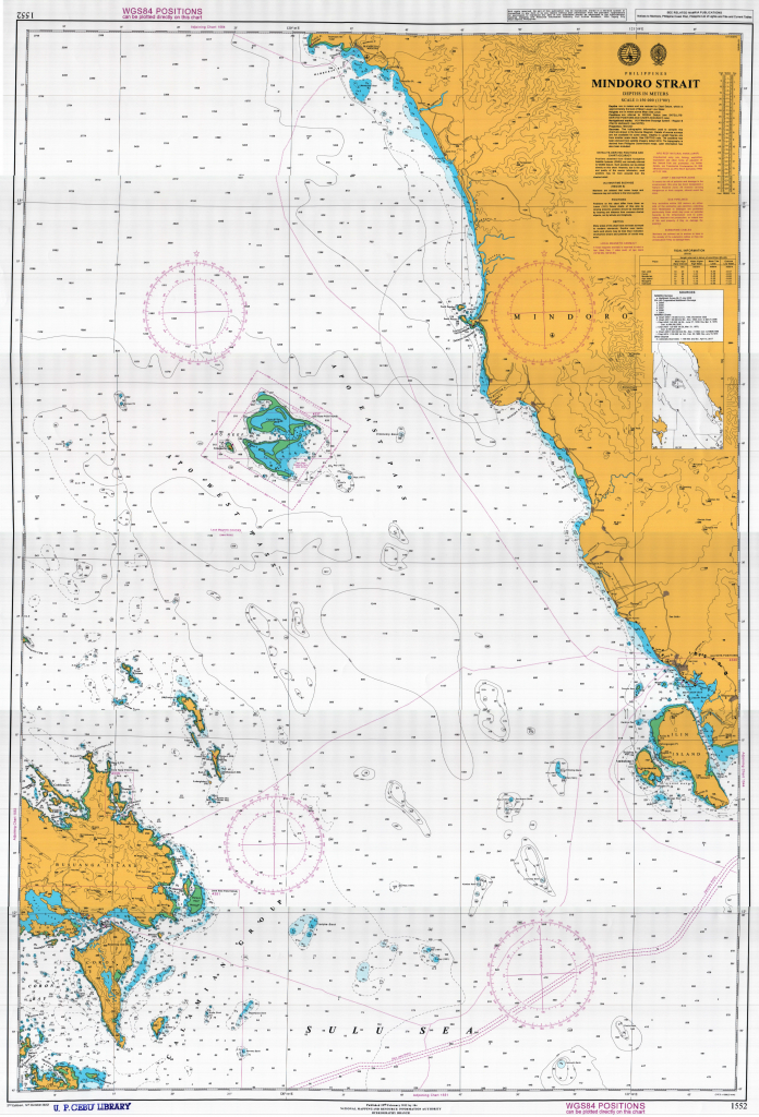
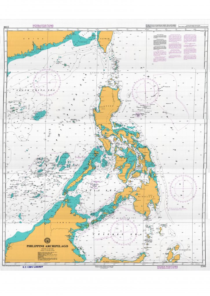
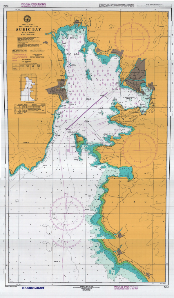
The following are the deposited maps to UP Cebu University Library for the public’s consumption. Should you need to use any of these maps, just tick the image and request for access permission (this is so to track utilization) or visit the library to see the actual sizeable maps.
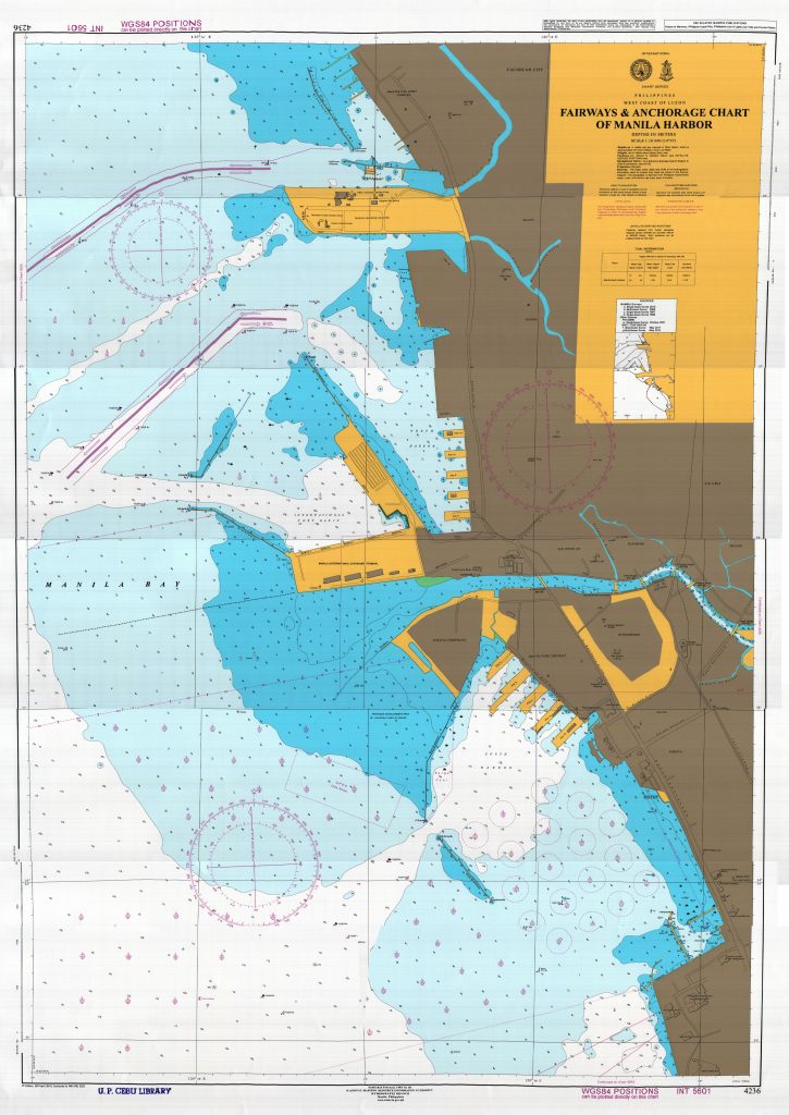 FAIRWAYS & ANCHORAGE CHART OF MANILA HARBOR
UPOC Note:
The Pasig River Dredging Project constructed the “Underwater Placement with Overdepth Capping” or UPOC to accommodate the dredged materials/sediments taken from the Pasig River bed.
SUBMARINE CABLES
Mariners are advised not to anchor or trawl in the vicinity of the submarine cables or they risk prosecution if they so damage them.
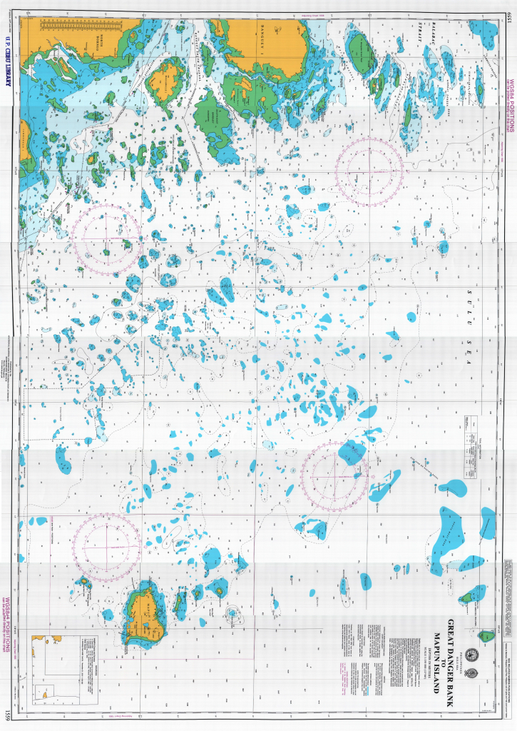 GREAT DANGER BANK TO MAPUN ISLAND
Shoal Areas. The shoal areas without contours depicted within the area of this chart have been derived from incomplete satellite imagery. Uncharted dangers may exist.
Aids to Navigation. Temporary defects in aids to navigation are not indicated on this chart except where a buoy replaces a fixed aid.
Vessel Reporting. For details of the Balabac Strait Reporting System, see Philippine Coast Pilot 7th Edition Volume 2.
Submarine Cables and Pipelines. Mariners are advised not to anchor or trawl in the vicinity of the submarine cables and pipelines or they risk prosecution if they so damage them.
Aids to Navigation. Temporary defects in aids to navigation are not indicated on this chart except where a buoy replaces a fixed aid.
IALA Maritime Buoyage (Region B). Mariners are advised that some buoys and beacons may not conform to the IALA system.
Local Magnetic Anomaly. A local magnetic anomaly is reported to exist in Apo West Pass, 7 miles south of Apo Island.
Apo Reef Natural Park (ARNP). Unauthorized entry into, fishing, exploration, exploitation and other forms of utilization of the Natural Park are prohibited. For further details see Presidential Proclamation No. 868 otherwise known as Apo Reef Natural Park Act of 1996.
ARNP 1 NM BUFFER ZONE. To avoid the risk of pollution and damage to the environment, this area has been designated a Nature Reserve Zone. All vessels carrying dangerous or toxic cargoes, should avoid the area.
Gas Pipelines. Any activities within 500 meters on either side of the submarine gas pipelines extending from Malampaya to Batangas are prohibited particularly those which may pose as potential hazards to the infrastructure and to public safety. Mariners risk prosecution, or instant loss of life and property, it they so damage the pipeline.
Submarine Cables. Mariners are advised not to anchor or trawl in the vicinity of the submarine cables or they risk prosecution if they so damage them.
Transit Corridors. All vessels navigating within the areas of Moro Gulf, Basilan Strait, Sulu Archipelago and Sibuto Passage are recommended to use the transit corridor for safer navigation. Vessels intending to use these corridors should notify the Philippine authorities.
Philippine – Indonesia Exclusive Economic Zone Boundary. The EEZ boundary that entered into force upon ratification of the agreement between the Republic of the Philippines and Republic of Indonesia concerning the delimitation of their EEZ Boundary.
Malampaya Exclusion Zone. Prohibited activities within the Exclusion Zone Boundary of Malampaya Gas Field are as follows: a) Entry of unauthorized vessels; b) Flying of aircraft below an altitude of 500 meters within a one kilometer radius away from dumping of the platform and CALM buoy; c) Use of an/or explosive; d) Sub-sea activities; e) All other activities which pose a potential risk to infrastructure and public safety.
Oil and Gas Pipelines. Any activity within 500 meters on either side of the submarine gas pipelines extending from Malampaya Gas Field to Batangas is prohibited particularly those which may pose as potential hazards to the infrastructure and to public safety. Mariners risk prosecution, or instant loss of life and property, if they damage the pipeline.
Philippine Rise Marine Resource Reserve (PRMRR). A resource reserve under the National Integrated Protected Areas System Act of 1992 is established in the area covering the Benham Bank.
Strict Protection Zone (SPZ). All activities are prohibited within the SPZ of PRMRR except those activities authorized by Philippine government.
Tubbataha Reefs Natural Park. Presidential Proclamation No. 1126, signed 23 August 2006, declared the Tubbataha Reefs National Marine Park in Palawan as Tubbataha Reef Natural Park under the National Integrated Protected Areas System (NIPAS) Act of 1992 (R.A. 7586) and the Strategic Environmental Plan for Palawan Act (R.A. 7611). Unauthorized entry into, fishing, exploration, exploitation and other forms of utilization of the National Park are prohibited.
Particularly Sensitive Sea Area (PSSA). An IMO-approved PSSA is designated in the area covering the Tubbataha Reef Natural Park.
Area to be Avoided (ATBA). To avoid the risk of pollution and damage to the environment, the area covering the Tubbataha Reefs Natural Park is designated as Area to be Avoided. All vessels of 150 gross tonnage and above should avoid the area. The limits of the ATBA coincides with limits of the PSSA. This area is IMO-adopted.
Apo Reef Natural Park (ARNP). Unauthorized entry into, fishing, exploration, exploitation and other forms of utilization of the Natural Park are prohibited.
Submarine Cables and Pipelines. Mariners are advised not to anchor or trawl in the vicinity of the submarine cables and pipelines or they risk prosecution if they so damage them.
Aids to Navigation. Temporary defects in aids to navigation are not indicated on this chart except where a buoy replaces a fixed aid.
IALA Maritime Buoyage (Region B). Mariners are advised that some buoys and beacons may not conform to the IALA system.
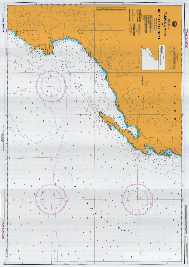 TARIGTIG POINT TO DICAPANISAN POINT
Depths. Many areas of this chart, especially close to the coast, have not been surveyed to modern standards. Depths over banks, reefs and shoals may be less than indicated. Uncharted shoals and patches of corals may exist.
Positions. Positions on this chart differ from those on Luzon (1911) Datum charts of this area by varying amounts; position should be transferred by bearing and distance from common charted objects, not by latitude and longitude.
Submarine Cables. Mariners are advised not to anchor or trawl in the vicinity of the submarine cables or they risk prosecution if they so damage them.
Depths. Many areas of this chart, especially close to the coast, have not been surveyed to modern standards. Depths over banks, reefs and shoals may be less than indicated. Uncharted shoals and patches of corals may exist.
IALA Maritime Buoyage (Region B). Mariners are advised that some buoys and beacons may not conform to the IALA system.
Positions. Positions on this chart differ from those on Luzon (1911) Datum charts of this area by varying amounts; position should be transferred by bearing and distance from common charted objects, not by latitude and longitude.
IALA Maritime Buoyage (Region B). Mariners are advised that some buoys and beacons may not conform to the IALA system.
Submarine Cables. Mariners are advised not to anchor or trawl in the vicinity of the submarine cables or they risk prosecution if they so damage them.
